
The land & river
Thirty-seven acres on the Fraser
Field, garden, forest and river, on the western bank between Quesnel and Williams Lake.
Land with a growing record. The farm sits on the western, silty banks of the Fraser River in the old township of Marguerite: about an acre of established gardens and some fifteen acres of open field, with licensed water to irrigate them and forest and river frontage beyond.
For a market gardener, a homesteader or a hobby farmer, the questions are the soil, the water and what the ground has already grown. Here is what we can document today.
The working land
The land and its water, side by side
The land
- Total
- 37 acres with Fraser River frontage
- Gardens
- About 1 acre of established gardens
- Open field
- Some 15 acres
- Zoning
- Rural 1 (RR 1), Cariboo Regional District
- ALR
- Within the Agricultural Land Reserve
Water for the land
- Licence
- Leonard Brook, priority date July 31, 1948 (issued 1958)
- Irrigation
- 20 acre-feet a year, April 1 to September 30, on up to 20 acres
- Domestic
- 500 gallons a day, year-round
- On the ground
- Two separate pump houses: the irrigation pump house supplies water to the garden area (some sprinklers and hoses are included), and a domestic pump house feeds the house, the shop, the barn and the outbuildings. The irrigation overflow runs out into the middle of the pond, and the overflow from the domestic pump house runs into the water feature (the cast-iron tub) and then into the pond.
- Source
- The spring at the head of Leonard Brook, just off the property
The full Water & Irrigation information package is available to serious buyers through LandQuest® Realty. Documents & tours →
Sources: Final Water Licence (BC); LandQuest® Realty listing MLS® R3137069, October 2026. Buyers should verify all details independently.
What this ground has grown
A market-garden record
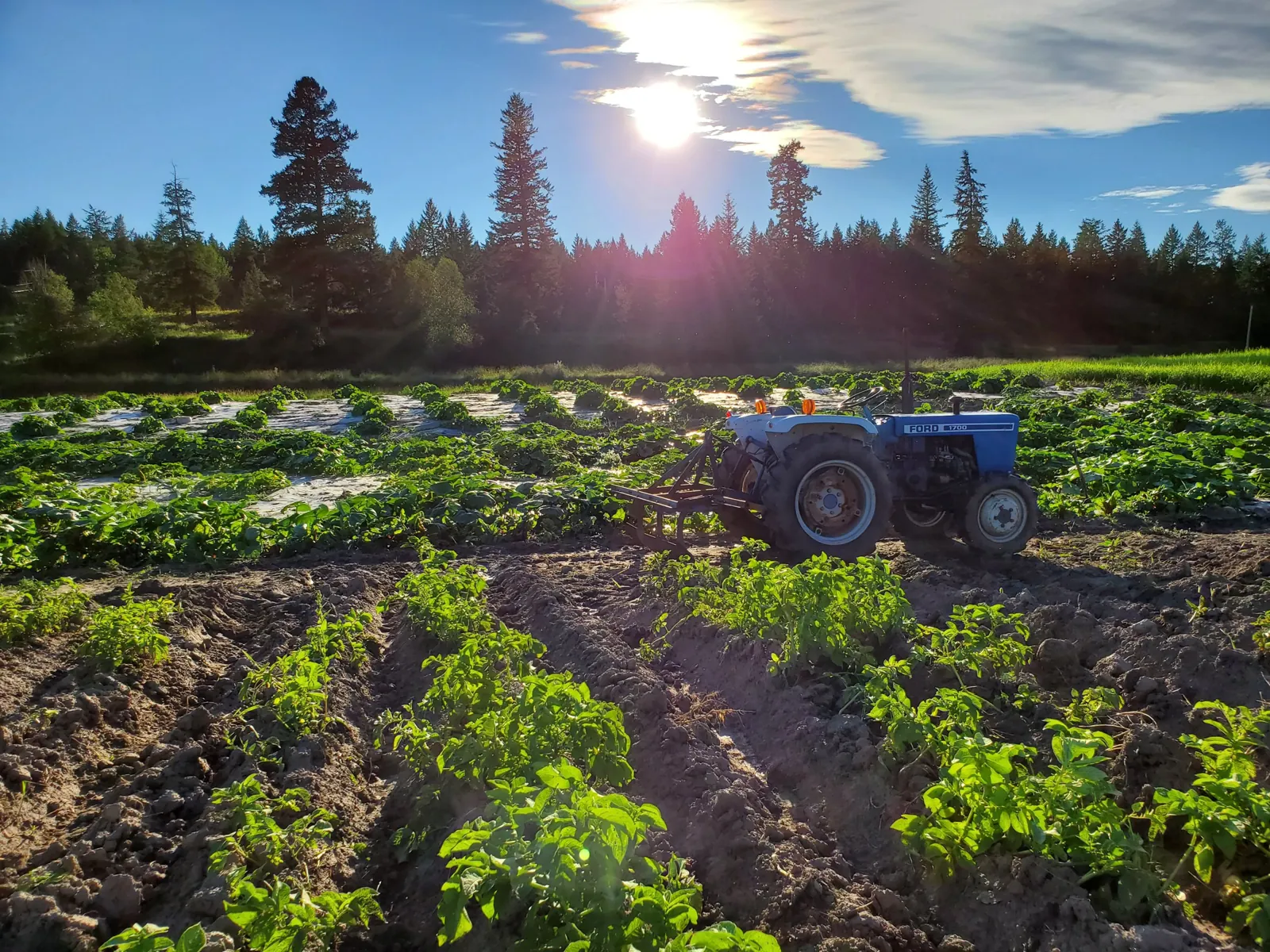
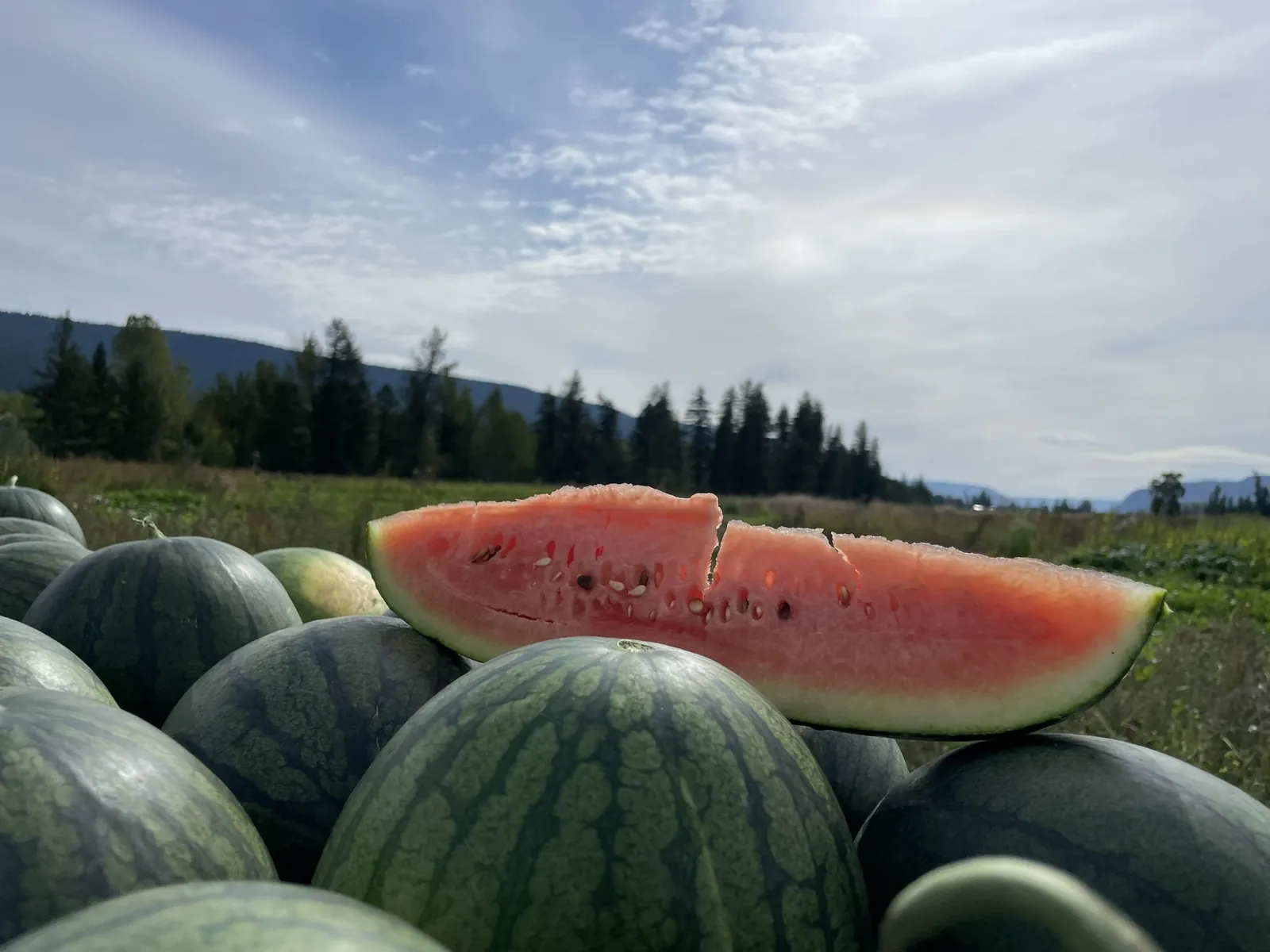
- Since about 2011–2012Watermelons on the river flats. In 2021–2024, the years of commercial growing, roughly 15,000 to 20,000 lb a year by the family’s estimate, sold in 100 Mile House, Williams Lake, Quesnel and Prince George.
- 2012Market-garden rows of sweet corn, greens and mulched beds for local farmers’ markets.
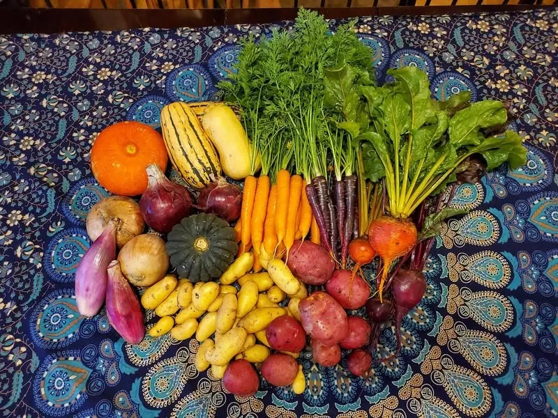
- 2020The Cariboo enRoot harvest box: potatoes, mixed squash, carrots, beets, cabbage and onions, delivered in Quesnel and Williams Lake.
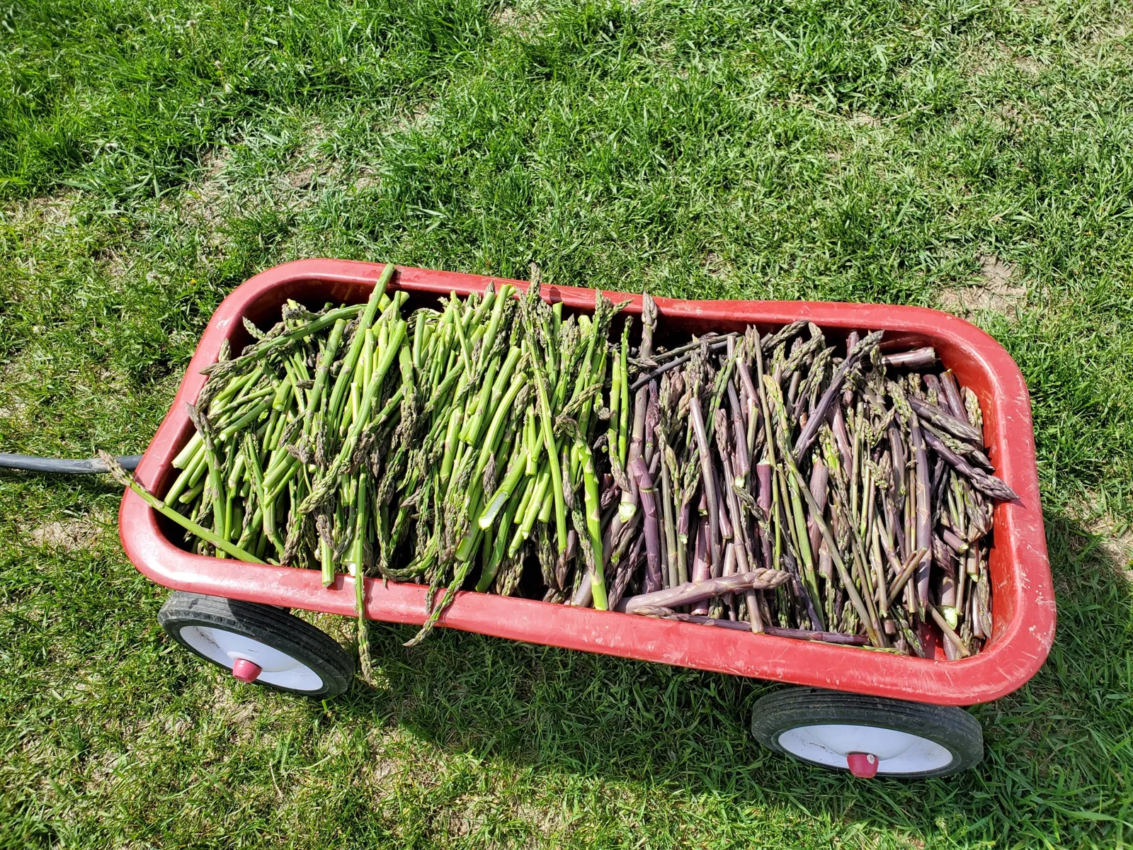
- Also grown hereCauliflower, peppers, kale and chard, zucchini, strawberries and asparagus, all in the farm’s own photographs.
- How it was farmedWith organic practices in mind: biological fertilizers and no sprays.
Microclimate
A banana belt on the Fraser
Locals know this stretch of the Fraser as a “banana belt”: warmer on average than the surrounding area, and drier, with less precipitation.
The farm sits in the same Fraser corridor as Soda Creek and its sweet corn, another spot known for its microclimate. In our own experience, we haven’t had to shovel the driveway for the past three years.
For a grower new to the Cariboo, it puts the farm’s record in context: watermelons, a hot-weather crop, have been grown here since about 2011–2012.
- Known locally as
- A “banana belt”: warmer and drier than the surrounding area
- Snow
- No driveway shovelling for the past three years, in the owners’ experience
- Same corridor
- Soda Creek, also known for its microclimate
- Hardiness zone
- Zone 5a at the farm (Natural Resources Canada plant hardiness zones, based on 1991–2020 climate data).

The banana-belt warmth, the lighter precipitation and the snow are local and owner knowledge, not measured data. Hardiness zones are a general guide and can change over short distances (Natural Resources Canada plant hardiness map).
Who it suits
Room for the way you want to farm
Market gardeners
An acre of established beds, open field beside them, licensed irrigation water and a selling history in four towns.
Homesteaders
An extensively renovated farmhouse with wood heat, a sauna, a woodshed, and a serviced trailer pad across the road for family or help.
Hobby farmers & river lovers
A 30×50 two-storey barn with power and water, a studio with two lofts, and Fraser River frontage with a gravel bar in late summer.
On film
The hayfields in summer


The valley
Benchlands rise on both sides of the river. This view looks north along the Fraser.

Getting here
- Location
- 9811 Marguerite Ferry West No. 2 Road, Cariboo, BC
- Access
- Mostly paved, with short gravel sections
- Towns
- About 45–60 minutes from either town
- Connectivity
- Starlink and cell
- Zoning
- RR 1, within the Agricultural Land Reserve
